A beautiful ridge hike that can be started from the top of the mountain. the height difference is covered with a historic steam cog railway up to the Brienzerrothorn. from there, a short route of about 10km or a long route of about 17km can be taken. However, if you choose the long route, beware that it is about 1000 meters of downhill at the end which you will feel in your knees!
The Meeting place for this beautiful ridge hike was directly at the cog railway station in Brienz, which is just across the street from the modern railway station where we arrived. In Summertime, the railway is very popular and it is advisable to show up early. Otherwise, you may be left behind and they only drive once an hour. the train ride itself also takes about half an hour, so you have plenty of time to enjoy the scenery and boy, there is lots to see!
Once arrived at the top, you have a fantastic view in almost all directions. If you want, you can have a quick breakfast in the mountainside restaurant and for the most adventurous, you can even spend the night. If you do spend the night, I recommend to book early and order a fondue for dinner. the advantage is that you will be able to start hiking early in the morning before any of the railways have made their trip up the mountain. You will have the whole mountain hike paths to yourselves and will be able to see a unique sunrise in the Swiss Alps.
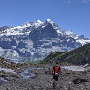
For us, we arrived at the top at around 9 o clock. the sun was already shining strong. We made a short pitstop for bio breaks and last purchases before we headed out.
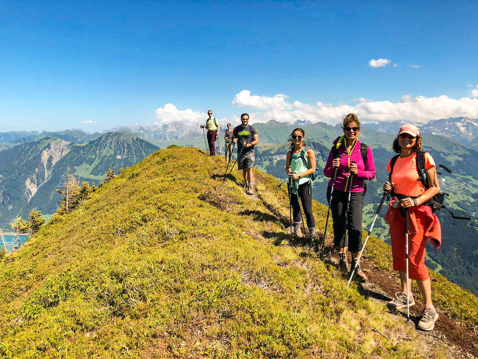
This ridge hike is particularly likable because it offers the opportunity to bail out in the middle. This allowed us to combine the group with people who wanted to try out ridge hiking with some more experienced hikers. The short route is about 10km from the railway and is mostly flat. It covers something like 200m of altitude and will take a bit more than 3 hours if you take your time. A map and height profile of the short route can be found here. After the lunch break, a short hour walk will take you to another cable car that will bring you down the valley. from there, its a short walk to the train station.
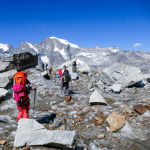
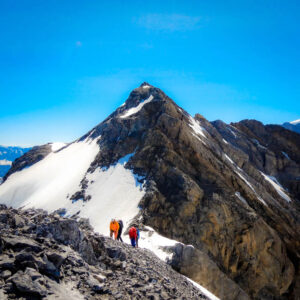
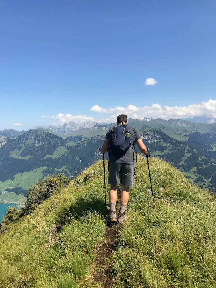
The longer route would continue after lunch for another 3 to 4 hours and would descend about 1000 meters to the Brünig and add another 7km to the total distance. But the most beautiful part of the hike was hidden here. But it isn’t easy to find. About an hour into the afternoon, we had to take the decision to follow the hiking sign or follow my mobile maps. the sign pointed down the side of the mountain, but we wanted to go up to the ridge. So we followed the mobile. And so we found the top of the ridge again. IT was another small ascend, but it was worth it! from the top, we could see almost endlessly into the distance. It was hard to say just how many lakes we were able to spot! It was definitely worth going the extra mile! A Map and height profile of the afternoon walk can be found here.
Reaching the top, there was only one way to go, down. We had roughly 1000m ahead of us. Luckily, it wasn’t all the way down the valley but just to the mountain pass of Brünig that also has a train station. never the less, we had already hiked for quite some time and our legs were starting to get weary. Some people were starting to feel it in their knees. Walking downhill for so long is tougher than it may sound. having good walking poles and knowing how to use them is key.
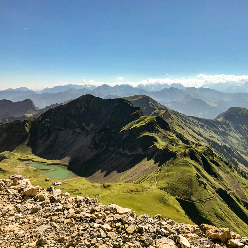
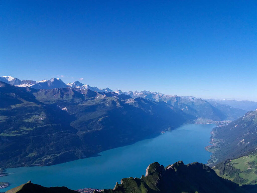
The route itself became less scenic as we descended. There were much fewer vies of the big 4000m peaks that we were previously able to gaze at. At this stage, we could see both sides of the valley though. On one side was Meiringen a known ski area and also the place where Sherlock Holmes famously fell to his death at the Reichenbach fall. On the other side lay the lakes of Lungern and Sarnen. And even further into the distance, the lake Lucerne was also visible.
the path took us more towards the Meiringen side and more and into troughs and moraines. The path itself was sometimes overgrown with fresh grass and wasn’t in the best of shapes. It would have gotten dangerous without poles. We really had to watch our step. After we had passed some high alpine grass fields we slowly started to enter marshes and forest lands again. Having spent most of the day under the blazing sun, we were happy for some shade. It is always cooler up in the mountains, but we were hiking on a particularly sunny day and have been exposed to the sun the whole day. There are no trees, no shadows, this high up.
As we headed through the shadows in the cool forest, one could clearly feel the energy dropping further. We were on our last legs. It was only a couple of kilometers to go, but it was still going downhill. Knees were hurting and even with the poles, our pace was getting slower and slower. And os we checked the train schedule and figured we didn’t have to hurry anyhow. with our current pace, we would arrive 20 minutes before the train. So we took our time and just enjoyed the last couple of steps in the shade.
We finally arrived at the train station in the early evening. Exhausted and thirsty. Luckily the local restaurant was still open and we grabbed a cold beer and some well-deserved ice cream. It was only now that it dawned on us that apart from our lunchtime restaurant, there was no possibility to replenish supplies, not even water. We all had enough provisions to cover for the distance. Make sure you do too if you want to repeat the routes and bring enough water.